
Zoar topographic map
Interactive map
Click on the map to display elevation.
About this map
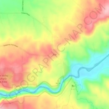
Name: Zoar topographic map, elevation, terrain.
Average elevation: 1,220 ft
Minimum elevation: 919 ft
Maximum elevation: 1,486 ft
Other topographic maps
Click on a map to view its topography, its elevation and its terrain.
Collins Center
United States > New York > Erie County > Town of Collins
Collins Center, Town of Collins, Erie County, New York, 14035, United States
Average elevation: 1,148 ft