
Ivohibe topographic map
Interactive map
Click on the map to display elevation.
About this map
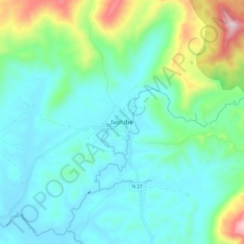
Name: Ivohibe topographic map, elevation, terrain.
Location: Ivohibe, Ihorombe, Province de Fianarantsoa, Madagascar (-22.52104 46.84814 -22.44104 46.92814)
Average elevation: 2,480 ft
Minimum elevation: 2,047 ft
Maximum elevation: 4,062 ft