
Córdoba topographic map
Interactive map
Click on the map to display elevation.
About this map
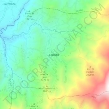
Name: Córdoba topographic map, elevation, terrain.
Location: Córdoba, Cordillerana, Quindío, 632020, Colombia (4.37007 -75.70582 4.41007 -75.66582)
Average elevation: 5,397 ft
Minimum elevation: 4,022 ft
Maximum elevation: 7,428 ft