
Tai Tapu topographic map
Interactive map
Click on the map to display elevation.
About this map
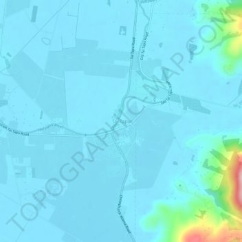
Name: Tai Tapu topographic map, elevation, terrain.
Location: Tai Tapu, Selwyn District, Canterbury, 7672, New Zealand (-43.67960 172.53023 -43.63960 172.57023)
Average elevation: 69 ft
Minimum elevation: 13 ft
Maximum elevation: 709 ft
Other topographic maps
Click on a map to view its topography, its elevation and its terrain.
Prebbleton
New Zealand > Canterbury > Selwyn District
Prebbleton, Selwyn District, Canterbury, 7604, New Zealand
Average elevation: 82 ft
Windwhistle
New Zealand > Canterbury > Selwyn District
Windwhistle, Selwyn District, Canterbury, New Zealand
Average elevation: 1,424 ft
Rolleston
New Zealand > Canterbury > Selwyn District
Rolleston, Selwyn District, Canterbury, 7643, New Zealand
Average elevation: 177 ft
Castle Hill Village
New Zealand > Canterbury > Selwyn District
Castle Hill Village, Selwyn District, Canterbury, 7580, New Zealand
Average elevation: 2,582 ft
Lincoln
New Zealand > Canterbury > Selwyn District
Lincoln, Selwyn District, Canterbury, 7608, New Zealand
Average elevation: 49 ft
Sheffield
New Zealand > Canterbury > Selwyn District
Sheffield, Selwyn District, Canterbury, 7500, New Zealand
Average elevation: 1,014 ft
West Melton
New Zealand > Canterbury > Selwyn District
West Melton, Selwyn District, Canterbury, 7618, New Zealand
Average elevation: 289 ft
Dunsandel
New Zealand > Canterbury > Selwyn District
Dunsandel, Selwyn District, Canterbury, 7682, New Zealand
Average elevation: 243 ft
Arthur's Pass
New Zealand > Canterbury > Selwyn District
Arthur's Pass, Selwyn District, Canterbury, 7875, New Zealand
Average elevation: 3,950 ft
Darfield
New Zealand > Canterbury > Selwyn District
Darfield, Selwyn District, Canterbury, 7510, New Zealand
Average elevation: 663 ft
Rakaia River
New Zealand > Canterbury > Selwyn District
Rakaia River, Selwyn District, Canterbury, New Zealand
Average elevation: 171 ft
Selwyn
New Zealand > Canterbury > Selwyn District
Selwyn, Selwyn District, Canterbury, 7682, New Zealand
Average elevation: 230 ft
Castle Hill Peak
New Zealand > Canterbury > Selwyn District
Castle Hill Peak, Selwyn District, Canterbury, New Zealand
Average elevation: 4,961 ft
Leeston
New Zealand > Canterbury > Selwyn District
Leeston, Selwyn District, Canterbury, 7632, New Zealand
Average elevation: 72 ft
Kirwee
New Zealand > Canterbury > Selwyn District
Kirwee, Selwyn District, Canterbury, New Zealand
Average elevation: 518 ft