
Sugarloaf topographic map
Interactive map
Click on the map to display elevation.
About this map
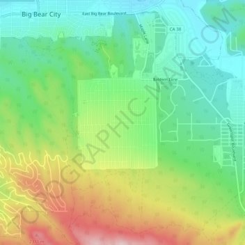
Name: Sugarloaf topographic map, elevation, terrain.
Location: Sugarloaf, San Bernardino County, California, 92386, USA (34.22334 -116.84892 34.26334 -116.80892)
Average elevation: 7,067 ft
Minimum elevation: 6,709 ft
Maximum elevation: 7,677 ft