
Karuhatan topographic map
Interactive map
Click on the map to display elevation.
About this map
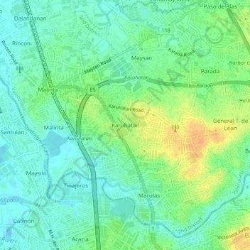
Name: Karuhatan topographic map, elevation, terrain.
Location: Karuhatan, Valenzuela, Metro Manila, 1441, Philippines (14.66668 120.95748 14.70668 120.99748)
Average elevation: 43 ft
Minimum elevation: -10 ft
Maximum elevation: 112 ft