
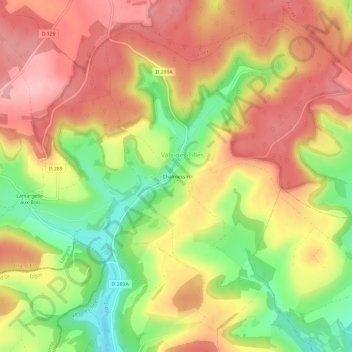
Chalmessin topographic map
Interactive map
Click on the map to display elevation.
About this map
Name: Chalmessin topographic map, elevation, terrain.
Average elevation: 1,427 ft
Minimum elevation: 1,148 ft
Maximum elevation: 1,634 ft
Other topographic maps
Click on a map to view its topography, its elevation and its terrain.
Villemervry
France > Grand Est > Haute-Marne > Vals-des-Tilles
Villemervry, Vals-des-Tilles, Langres, Haute-Marne, Grand Est, France métropolitaine, 52160, France
Average elevation: 1,381 ft
Musseau
France > Grand Est > Haute-Marne > Vals-des-Tilles
Musseau, Vals-des-Tilles, Langres, Haute-Marne, Grand Est, France métropolitaine, 52160, France
Average elevation: 1,457 ft