
Fexhe-le-Haut-Clocher topographic map
Interactive map
Click on the map to display elevation.
About this map
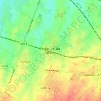
Name: Fexhe-le-Haut-Clocher topographic map, elevation, terrain.
Location: Fexhe-le-Haut-Clocher, Waremme, Liège, Wallonie, 4347, Belgique (50.64431 5.37938 50.68431 5.41938)
Average elevation: 512 ft
Minimum elevation: 436 ft
Maximum elevation: 594 ft