
Heiligenstadt topographic map
Interactive map
Click on the map to display elevation.
About this map
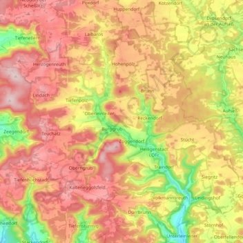
Name: Heiligenstadt topographic map, elevation, terrain.
Location: Heiligenstadt, Landkreis Bamberg, Bavaria, 91332, Germany (49.83228 11.06154 49.92527 11.24400)
Average elevation: 1,535 ft
Minimum elevation: 1,040 ft
Maximum elevation: 1,919 ft