Geolocate

Arnhem topographic map

Click on the map to display elevation.

About this map

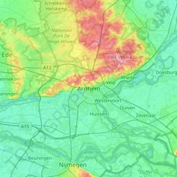
Name: Arnhem topographic map, elevation, terrain.

Location: Arnhem, Gelderland, Netherlands, 6811AL, Netherlands (51.82426 5.75086 52.14426 6.07086)

Average elevation: 79 ft

Minimum elevation: 7 ft

Maximum elevation: 344 ft

Gear up for your next adventure:

🧭Hiking Compass - Precision compass for reliable navigation in the wilderness
📡Handheld GPS Device - Reliable handheld GPS for outdoor navigation
🧭Pro Hiking Compasses - High-accuracy liquid-filled compasses for topographic orientation
🧼Biodegradable Camping Soap - Eco‑friendly soap for outdoor hygiene
Backpacking Tent - Lightweight and durable tent for multi‑day hikes

As an Amazon Associate, this site earns from qualifying purchases at no extra cost to you.