
Bonnet Hill topographic map
Interactive map
Click on the map to display elevation.
About this map
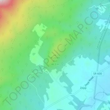
Name: Bonnet Hill topographic map, elevation, terrain.
Location: Bonnet Hill, Shenandoah County, Virginia, United States (39.01478 -78.50673 39.01488 -78.50663)
Average elevation: 1,283 ft
Minimum elevation: 978 ft
Maximum elevation: 2,188 ft
Other topographic maps
Click on a map to view its topography, its elevation and its terrain.
Mount Jackson
United States > Virginia > Shenandoah County
Mount Jackson, Shenandoah County, Virginia, United States
Average elevation: 1,004 ft
New Market
United States > Virginia > Shenandoah County
New Market, Shenandoah County, Virginia, 22844, United States
Average elevation: 1,017 ft
Strasburg
United States > Virginia > Shenandoah County
Strasburg, Shenandoah County, Virginia, United States
Average elevation: 640 ft
Woodstock
United States > Virginia > Shenandoah County
Woodstock, Shenandoah County, Virginia, United States
Average elevation: 827 ft