
Ancre topographic map
Interactive map
Click on the map to display elevation.
About this map
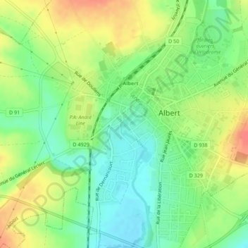
Name: Ancre topographic map, elevation, terrain.
Average elevation: 233 ft
Minimum elevation: 154 ft
Maximum elevation: 331 ft
Other topographic maps
Click on a map to view its topography, its elevation and its terrain.
Ancre
France > Hauts-de-France > Somme > Albert
Ancre, Albert, Péronne, Somme, Hauts-de-France, France métropolitaine, 80300, France
Average elevation: 246 ft
Ancre
France > Hauts-de-France > Somme > Albert
Ancre, Albert, Péronne, Somme, Hauts-de-France, France métropolitaine, 80300, France
Average elevation: 203 ft
Ancre
France > Hauts-de-France > Somme > Albert
Ancre, Albert, Péronne, Somme, Hauts-de-France, France métropolitaine, 80300, France
Average elevation: 236 ft