
Negreira topographic map
Interactive map
Click on the map to display elevation.
About this map
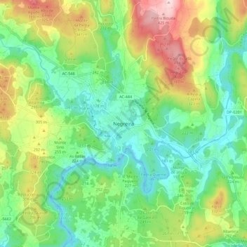
Name: Negreira topographic map, elevation, terrain.
Location: Negreira, A Barcala, A Corogne, Galice, 15830, Espagne (42.87097 -8.77496 42.95097 -8.69496)
Average elevation: 771 ft
Minimum elevation: 420 ft
Maximum elevation: 1,440 ft
Other topographic maps
Click on a map to view its topography, its elevation and its terrain.