
洪山 topographic map
Interactive map
Click on the map to display elevation.
About this map
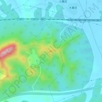
Name: 洪山 topographic map, elevation, terrain.
Location: 洪山, 镇江市, 江苏省, 中国 (32.15544 119.14348 32.15554 119.14358)
Average elevation: 171 ft
Minimum elevation: 23 ft
Maximum elevation: 814 ft
Other topographic maps
Click on a map to view its topography, its elevation and its terrain.