Geolocate

Old Beach topographic map

Click on the map to display elevation.

About this map

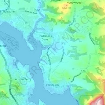
Name: Old Beach topographic map, elevation, terrain.

Location: Old Beach, Hobart, Brighton, Tasmania, Australia (-42.78846 147.26052 -42.72829 147.32793)

Average elevation: 184 ft

Minimum elevation: -13 ft

Maximum elevation: 1,217 ft

Other topographic maps

Click on a map to view its topography, its elevation and its terrain.

Waterworks Reserve

Australia > Tasmania > Hobart

Average elevation: 787 ft

Gear up for your next adventure:

🛰️Handheld GPS Units - Professional satellite navigators for precise backcountry mapping
📚USA Hiking Guide Books - Top trail guides and map books
🥘Titanium Cookware - Durable, featherlight pots and pans for backpacking
🗺️Topographic Maps - Detailed topo maps for hiking, exploring and outdoor navigation
⛑️Personal Locator Beacon - Safety beacon for emergencies

As an Amazon Associate, this site earns from qualifying purchases at no extra cost to you.