
D 955 topographic map
Interactive map
Click on the map to display elevation.
About this map
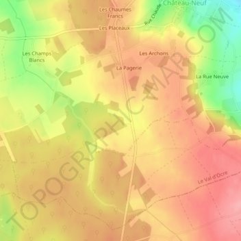
Name: D 955 topographic map, elevation, terrain.
Average elevation: 774 ft
Minimum elevation: 551 ft
Maximum elevation: 899 ft
Other topographic maps
Click on a map to view its topography, its elevation and its terrain.
Lampy
France > Bourgogne-Franche-Comté > Yonne > Le Val d'Ocre
Lampy, Saint-Aubin-Château-Neuf, Le Val d'Ocre, Auxerre, Yonne, Bourgogne-Franche-Comté, France métropolitaine, 89110, France
Average elevation: 679 ft
Saint-Aubin-Château-Neuf
France > Bourgogne-Franche-Comté > Yonne > Le Val d'Ocre
Saint-Aubin-Château-Neuf, Le Val d'Ocre, Auxerre, Yonne, Bourgogne-Franche-Comté, France métropolitaine, 89110, France
Average elevation: 692 ft