
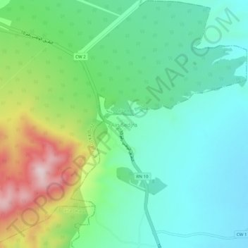
Aïn Chadjra topographic map
Interactive map
Click on the map to display elevation.
About this map
Name: Aïn Chadjra topographic map, elevation, terrain.
Location: Aïn Chadjra, El Rahia, Daïra Meskiana, Oum El Bouaghi, Algérie (35.74414 7.56106 35.78414 7.60106)
Average elevation: 3,369 ft
Minimum elevation: 2,982 ft
Maximum elevation: 4,295 ft