
Kumarghat topographic map
Interactive map
Click on the map to display elevation.
About this map
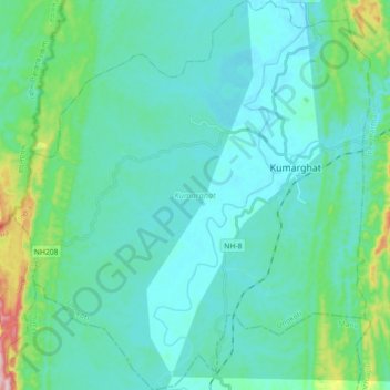
Name: Kumarghat topographic map, elevation, terrain.
Location: Kumarghat, Unokoti, Tripura, India (24.06755 91.90787 24.23112 92.07281)
Average elevation: 246 ft
Minimum elevation: 89 ft
Maximum elevation: 1,112 ft