
Lahérie topographic map
Interactive map
Click on the map to display elevation.
About this map
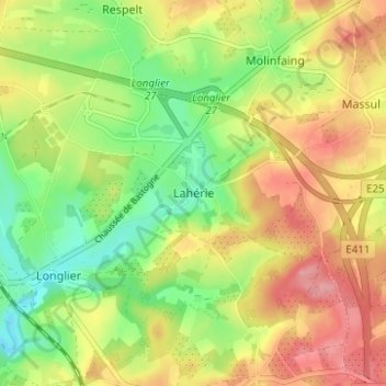
Name: Lahérie topographic map, elevation, terrain.
Location: Lahérie, Longlier, Neufchâteau, Luxembourg, Wallonie, Belgique (49.84478 5.46264 49.88478 5.50264)
Average elevation: 1,499 ft
Minimum elevation: 1,322 ft
Maximum elevation: 1,690 ft