
Ploudalmézeau topographic map
Interactive map
Click on the map to display elevation.
About this map
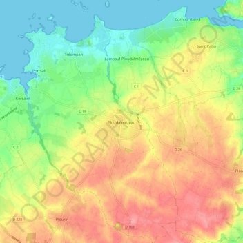
Name: Ploudalmézeau topographic map, elevation, terrain.
Average elevation: 135 ft
Minimum elevation: -3 ft
Maximum elevation: 279 ft
La superficie de la commune est de 23,2 km2 ; son altitude moyenne est de 55 mètres, variant de 0 à 84 mètres.