
Croesyceiliog topographic map
Interactive map
Click on the map to display elevation.
About this map
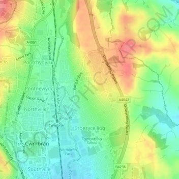
Name: Croesyceiliog topographic map, elevation, terrain.
Location: Croesyceiliog, Torfaen, Pays de Galles, Royaume-Uni (51.65142 -3.01674 51.67209 -2.98913)
Average elevation: 272 ft
Minimum elevation: 161 ft
Maximum elevation: 420 ft