
Hohenstein-Ernstthal topographic map
Interactive map
Click on the map to display elevation.
About this map
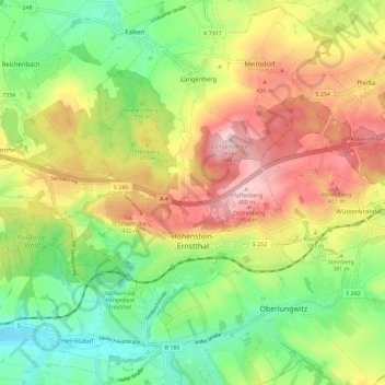
Name: Hohenstein-Ernstthal topographic map, elevation, terrain.
Location: Hohenstein-Ernstthal, Zwickau, Saxe, 09337, Allemagne (50.78855 12.65435 50.83392 12.76910)
Average elevation: 1,211 ft
Minimum elevation: 906 ft
Maximum elevation: 1,581 ft