
Den Treek Henschoten topographic map
Interactive map
Click on the map to display elevation.
About this map
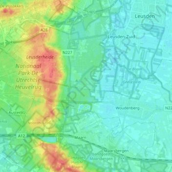
Name: Den Treek Henschoten topographic map, elevation, terrain.
Location: Den Treek Henschoten, Amersfoort, Utrecht, Nederland (52.04589 5.30879 52.13892 5.40447)
Average elevation: 46 ft
Minimum elevation: 3 ft
Maximum elevation: 177 ft
Other topographic maps
Click on a map to view its topography, its elevation and its terrain.
Hoogland
Nederland > Utrecht > Amersfoort
Hoogland, Amersfoort, Utrecht, Nederland
Average elevation: 7 ft
Palestina
Nederland > Utrecht > Amersfoort
Palestina, Amersfoort, Utrecht, Nederland, 3826 NE, Nederland
Average elevation: 7 ft