
Al Mashael District topographic map
Interactive map
Click on the map to display elevation.
About this map
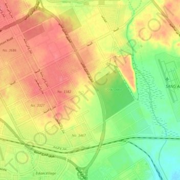
Name: Al Mashael District topographic map, elevation, terrain.
Average elevation: 1,896 ft
Minimum elevation: 1,785 ft
Maximum elevation: 1,988 ft
Other topographic maps
Click on a map to view its topography, its elevation and its terrain.
Zahrat al Badiah District
Zahrat al Badiah District, Al-Urayja Municipality, Riyadh, Riyadh Region, 12783-8458, Saudi Arabia
Average elevation: 2,133 ft
Al Muruj
Saudi Arabia > Riyadh > Al Muruj
Al Muruj, Riyadh, Riyadh Region, 11552, Saudi Arabia
Average elevation: 2,096 ft