
Yerupajá Chico topographic map
Interactive map
Click on the map to display elevation.
About this map
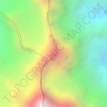
Name: Yerupajá Chico topographic map, elevation, terrain.
Location: Yerupajá Chico, Pacllón, Bolognesi, Áncash, Perú (-10.25229 -76.90353 -10.25219 -76.90343)
Average elevation: 17,372 ft
Minimum elevation: 14,613 ft
Maximum elevation: 21,040 ft
Other topographic maps
Click on a map to view its topography, its elevation and its terrain.
Jirishanca
Jirishanca, Pacllón, Bolognesi, Áncash, Perú
Average elevation: 17,054 ft