
Culbertson topographic map
Interactive map
Click on the map to display elevation.
About this map
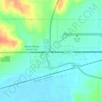
Name: Culbertson topographic map, elevation, terrain.
Location: Culbertson, Roosevelt County, Montana, United States (48.14054 -104.52490 48.15773 -104.49763)
Average elevation: 1,952 ft
Minimum elevation: 1,903 ft
Maximum elevation: 2,093 ft
Other topographic maps
Click on a map to view its topography, its elevation and its terrain.
Wolf Point
United States > Montana > Roosevelt County
Wolf Point, Wolf Point District, Roosevelt County, Montana, United States
Average elevation: 2,018 ft
Poplar
United States > Montana > Roosevelt County
Poplar, Poplar District, Roosevelt County, Montana, United States
Average elevation: 1,969 ft