
石家庄镇 topographic map
Interactive map
Click on the map to display elevation.
About this map
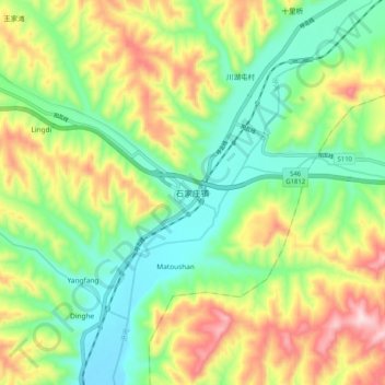
Name: 石家庄镇 topographic map, elevation, terrain.
Location: 石家庄镇, 宁武县, 忻州市, 山西省, 中国 (38.53535 111.97593 38.61535 112.05593)
Average elevation: 4,774 ft
Minimum elevation: 4,262 ft
Maximum elevation: 5,614 ft
Other topographic maps
Click on a map to view its topography, its elevation and its terrain.