Faßberg topographic map
Interactive map
Click on the map to display elevation.
About this map
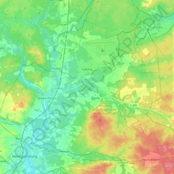
Name: Faßberg topographic map, elevation, terrain.
Location: Faßberg, Landkreis Celle, Niedersachsen, 29328, Deutschland (52.83355 10.05849 52.93660 10.28112)
Average elevation: 253 ft
Minimum elevation: 164 ft
Maximum elevation: 420 ft
Other topographic maps
Click on a map to view its topography, its elevation and its terrain.
Celle
Deutschland > Niedersachsen > Landkreis Celle
Celle, Landkreis Celle, Niedersachsen, Deutschland
Average elevation: 157 ft
Bergen
Deutschland > Niedersachsen > Landkreis Celle
Bergen, Landkreis Celle, Niedersachsen, 29303, Deutschland
Average elevation: 217 ft
Celle
Deutschland > Niedersachsen > Landkreis Celle > Celle > Celle
Celle, Landkreis Celle, Niedersachsen, 29221, Deutschland
Average elevation: 148 ft