
Steyr topographic map
Interactive map
Click on the map to display elevation.
About this map
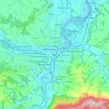
Name: Steyr topographic map, elevation, terrain.
Location: Steyr, Opper-Oostenrijk, 4407, Oostenrijk (47.99900 14.37913 48.07900 14.45913)
Average elevation: 1,240 ft
Minimum elevation: 915 ft
Maximum elevation: 2,631 ft