
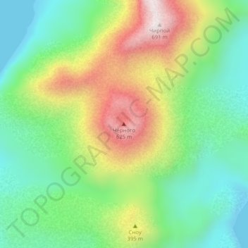
Чёрного topographic map
Interactive map
Click on the map to display elevation.
About this map
Name: Чёрного topographic map, elevation, terrain.
Average elevation: 817 ft
Minimum elevation: 0 ft
Maximum elevation: 2,185 ft
Other topographic maps
Click on a map to view its topography, its elevation and its terrain.
Оха
Russie > Сахалинская область > Оха
Оха, Охинский городской округ, Сахалинская область, District fédéral extrême-oriental, 694490, Russie
Average elevation: 85 ft