
Aït Ziki topographic map
Interactive map
Click on the map to display elevation.
About this map
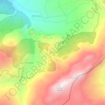
Name: Aït Ziki topographic map, elevation, terrain.
Location: Aït Ziki, Daïra Bouzguen, Tizi Ouzou, RADP (36.54585 4.48680 36.58585 4.52680)
Average elevation: 3,629 ft
Minimum elevation: 1,703 ft
Maximum elevation: 5,535 ft