
Wembury topographic map
Interactive map
Click on the map to display elevation.
About this map
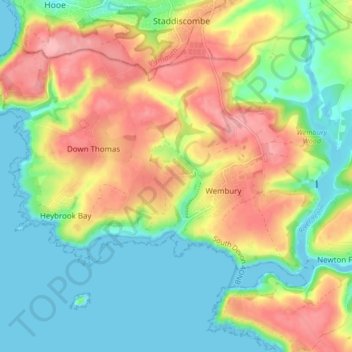
Name: Wembury topographic map, elevation, terrain.
Location: Wembury, South Hams, Devon, England, United Kingdom (50.30591 -4.12929 50.34682 -4.04512)
Average elevation: 164 ft
Minimum elevation: -23 ft
Maximum elevation: 394 ft