
Braga (São Vicente) topographic map
Interactive map
Click on the map to display elevation.
About this map
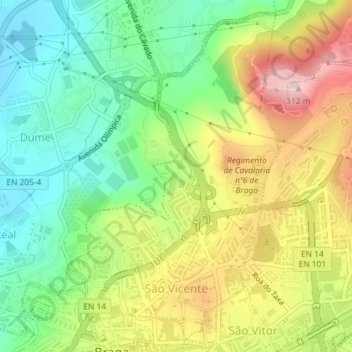
Name: Braga (São Vicente) topographic map, elevation, terrain.
Location: Braga (São Vicente), Dume, Braga, Portugal (41.55205 -8.43243 41.57703 -8.41080)
Average elevation: 528 ft
Minimum elevation: 194 ft
Maximum elevation: 991 ft