
Kukës topographic map
Interactive map
Click on the map to display elevation.
About this map
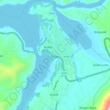
Name: Kukës topographic map, elevation, terrain.
Average elevation: 1,142 ft
Minimum elevation: 909 ft
Maximum elevation: 3,091 ft
Other topographic maps
Click on a map to view its topography, its elevation and its terrain.
Pakisht
Albania > Northern Albania > Kukës County > Bashkia Kukës
Pakisht, Bashkia Kukës, Kukës County, Northern Albania, 8515, Albania
Average elevation: 3,809 ft