
Oosteinde topographic map
Interactive map
Click on the map to display elevation.
About this map
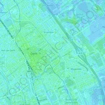
Name: Oosteinde topographic map, elevation, terrain.
Location: Oosteinde, Delft, Südholland, Niederlande, 2611VE, Niederlande (52.01090 4.36256 52.01247 4.36912)
Average elevation: 10 ft
Minimum elevation: -13 ft
Maximum elevation: 20 ft
Other topographic maps
Click on a map to view its topography, its elevation and its terrain.