
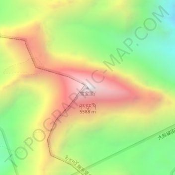
雪宝顶 topographic map
Interactive map
Click on the map to display elevation.
About this map
Name: 雪宝顶 topographic map, elevation, terrain.
Location: 雪宝顶, 施家堡乡, 松潘县, 阿坝藏族羌族自治州, 四川省, 中国 (32.67581 103.84678 32.67591 103.84688)
Average elevation: 15,932 ft
Minimum elevation: 13,809 ft
Maximum elevation: 18,320 ft