
博格达峰 topographic map
Interactive map
Click on the map to display elevation.
About this map
Name: 博格达峰 topographic map, elevation, terrain.
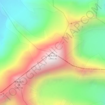
Location: 博格达峰, 阿克苏乡, 乌鲁木齐市, 达坂城区, 新疆维吾尔自治区, 830000, 中国 (43.80149 88.33493 43.80159 88.33503)
Average elevation: 14,944 ft
Minimum elevation: 12,664 ft
Maximum elevation: 17,707 ft
博格达峰是天山山脉东段的著名高峰,位于中国新疆维吾尔自治区中部乌鲁木齐市附近昌吉回族自治州阜康市境内,海拔5,445米,位于东经88.3度,北纬43.8度,是天山山脉东段北支博格达山的主峰,也是是东段最高的山峰。“博格达”为蒙古语,“神山”、“神居之所”的意思。
Other topographic maps
Click on a map to view its topography, its elevation and its terrain.