
梧桐乡 topographic map
Interactive map
Click on the map to display elevation.
About this map
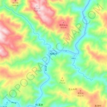
Name: 梧桐乡 topographic map, elevation, terrain.
Location: 梧桐乡, 丽水市, 景宁畲族自治县, 浙江省, 中国 (27.84973 119.46995 27.92973 119.54995)
Average elevation: 1,762 ft
Minimum elevation: 584 ft
Maximum elevation: 3,632 ft