
Arquennes topographic map
Interactive map
Click on the map to display elevation.
About this map
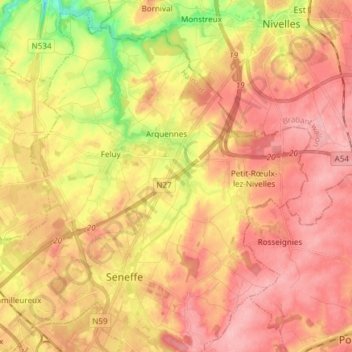
Name: Arquennes topographic map, elevation, terrain.
Location: Arquennes, Seneffe, Hainaut, Wallonie, 7181, Belgique (50.51109 4.18627 50.60159 4.33628)
Average elevation: 407 ft
Minimum elevation: 164 ft
Maximum elevation: 551 ft
Other topographic maps
Click on a map to view its topography, its elevation and its terrain.
Petit-Roeulx-lez-Nivelles
Petit-Roeulx-lez-Nivelles, Seneffe, Charleroi, Hainaut, Wallonie, 7181, Belgique
Average elevation: 463 ft
Familleureux
Familleureux, Seneffe, Hainaut, Wallonie, 7181, Belgique
Average elevation: 394 ft
Château de Miremont
Château de Miremont, 20, Chaussée de Marche, Feluy, Seneffe, Charleroi, Hainaut, Wallonie, 7181, Belgique
Average elevation: 354 ft