
Thank you for supporting this site ❤️
Make a donation
Make a donation
Gear up for your next adventure:
As an Amazon Associate, this site earns from qualifying purchases at no extra cost to you.
Qihe topographic map
Click on the map to display elevation.
Thank you for supporting this site ❤️
Make a donation
Make a donation
Gear up for your next adventure:
As an Amazon Associate, this site earns from qualifying purchases at no extra cost to you.
About this map
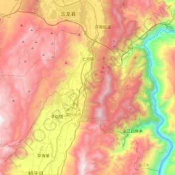
Name: Qihe topographic map, elevation, terrain.
Location: Qihe, Gucheng District, Lijiang City, Yunnan, China (26.60587 100.07938 26.80115 100.40294)
Average elevation: 8,297 ft
Minimum elevation: 4,035 ft
Maximum elevation: 11,929 ft
Thank you for supporting this site ❤️
Make a donation
Make a donation
Gear up for your next adventure:
As an Amazon Associate, this site earns from qualifying purchases at no extra cost to you.