
El Pinazo topographic map
Interactive map
Click on the map to display elevation.
About this map
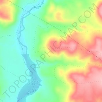
Name: El Pinazo topographic map, elevation, terrain.
Average elevation: 2,822 ft
Minimum elevation: 2,608 ft
Maximum elevation: 3,107 ft
Other topographic maps
Click on a map to view its topography, its elevation and its terrain.
La Serrota
España > Castilla-La Mancha > Albaladejo del Cuende
La Serrota, Albaladejo del Cuende, Cuenca, Castilla-La Mancha, España
Average elevation: 3,136 ft