
Puno topographic map
Interactive map
Click on the map to display elevation.
About this map
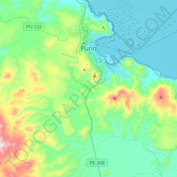
Name: Puno topographic map, elevation, terrain.
Location: Puno, Pérou (-16.02410 -70.18442 -15.77385 -69.91987)
Average elevation: 13,159 ft
Minimum elevation: 12,490 ft
Maximum elevation: 15,607 ft