
Le Marais d'Orx topographic map
Interactive map
Click on the map to display elevation.
About this map
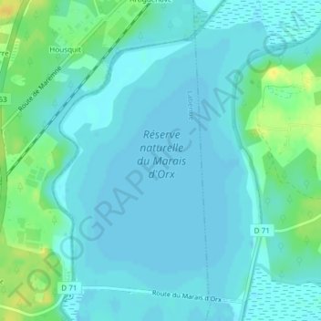
Name: Le Marais d'Orx topographic map, elevation, terrain.
Average elevation: 20 ft
Minimum elevation: 0 ft
Maximum elevation: 75 ft
Other topographic maps
Click on a map to view its topography, its elevation and its terrain.
Le Marais d'Orx
France > Nouvelle-Aquitaine > Orx
Le Marais d'Orx, D 71, Orx, Dax, Landes, Nouvelle-Aquitaine, France métropolitaine, 40230, France
Average elevation: 30 ft