
Cour du Pont Patin topographic map
Interactive map
Click on the map to display elevation.
About this map
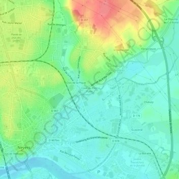
Name: Cour du Pont Patin topographic map, elevation, terrain.
Average elevation: 630 ft
Minimum elevation: 551 ft
Maximum elevation: 794 ft
Other topographic maps
Click on a map to view its topography, its elevation and its terrain.
L'Hermitage
France > Bourgogne-Franche-Comté > Nièvre > Coulanges-lès-Nevers
L'Hermitage, Coulanges-lès-Nevers, Nevers, Nièvre, Bourgogne-Franche-Comté, France métropolitaine, 58660, France
Average elevation: 646 ft