
Willersdorf topographic map
Interactive map
Click on the map to display elevation.
About this map
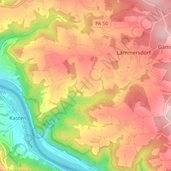
Name: Willersdorf topographic map, elevation, terrain.
Location: Willersdorf, Landkreis Passau, Bayern, 94107, Deutschland (48.53082 13.65824 48.57082 13.69824)
Average elevation: 1,572 ft
Minimum elevation: 902 ft
Maximum elevation: 2,096 ft