
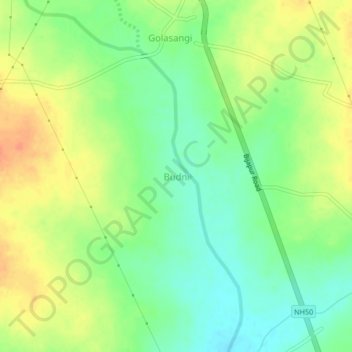
Budni topographic map
Interactive map
Click on the map to display elevation.
About this map
Name: Budni topographic map, elevation, terrain.
Average elevation: 1,831 ft
Minimum elevation: 1,765 ft
Maximum elevation: 1,906 ft
Other topographic maps
Click on a map to view its topography, its elevation and its terrain.
Nidagundi
India > Karnataka > Nidagundi Taluku
Nidagundi, Nidagundi Taluku, Vijayapura district, Karnataka, India
Average elevation: 1,719 ft