
Castuera topographic map
Interactive map
Click on the map to display elevation.
About this map
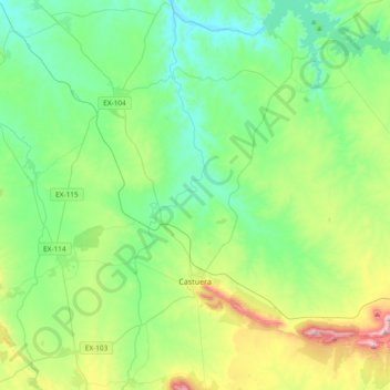
Name: Castuera topographic map, elevation, terrain.
Location: Castuera, Badajoz, Estremadura, Espanha (38.64365 -5.64110 38.93539 -5.32700)
Average elevation: 1,375 ft
Minimum elevation: 889 ft
Maximum elevation: 2,799 ft