
Beranga topographic map
Interactive map
Click on the map to display elevation.
About this map
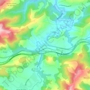
Name: Beranga topographic map, elevation, terrain.
Location: Beranga, Trasmiera, Cantabria, Cantabrie, 39730, Espagne (43.39547 -3.59624 43.43547 -3.55624)
Average elevation: 344 ft
Minimum elevation: 62 ft
Maximum elevation: 912 ft