
Hortunas topographic map
Interactive map
Click on the map to display elevation.
About this map
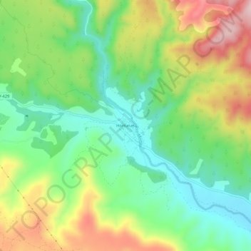
Name: Hortunas topographic map, elevation, terrain.
Average elevation: 2,103 ft
Minimum elevation: 1,716 ft
Maximum elevation: 2,697 ft
Other topographic maps
Click on a map to view its topography, its elevation and its terrain.
El Clérigo
Espagne > Communauté Valencienne > Requena
El Clérigo, Requena, La Plana de Utiel-Requena, Valence, Communauté Valencienne, Espagne
Average elevation: 2,615 ft