Geolocate

Arcozelo topographic map

Click on the map to display elevation.

About this map

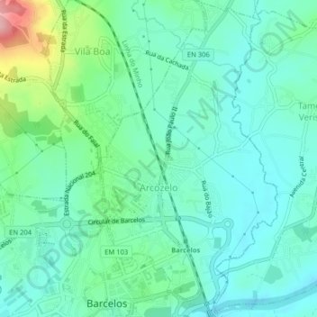
Name: Arcozelo topographic map, elevation, terrain.

Location: Arcozelo, Barcelos, Braga, Portugal (41.53018 -8.62013 41.56002 -8.59772)

Average elevation: 125 ft

Minimum elevation: 7 ft

Maximum elevation: 509 ft

Other topographic maps

Click on a map to view its topography, its elevation and its terrain.

Franqueira

Portugal > Braga > Barcelos

Average elevation: 479 ft

Gear up for your next adventure:

🪶Survival Guide Book - Expert advice for emergency preparedness
🥾Hiking Shoes - Durable and comfortable shoes for trail hiking
🍳Camping Cook Set - Complete cookware for outdoor meals
🌄Hiking Binoculars - Compact binoculars for scenic views and trail spotting
☀️Outdoor Sunscreen - High protection sunscreen for outdoor activities

As an Amazon Associate, this site earns from qualifying purchases at no extra cost to you.